Loading
Along with widespread rain, snow fell in the Flinders Ranges in South Australia on Friday, while Tasmania recorded its lowest temperature – minus 14.2 degrees at Liawenee – and the equal lowest for anywhere in Australia for the past nine years, Mr Domensino said.
Sydney will dodge most of the rain, although showers will return over the weekend and linger into Tuesday.
By 9.30pm Friday, several areas on the South Coast exceeded 50 millimetres of rain in the past 12 hours, and parts of Sydney including Observatory Hill, Rose Bay, and Cronulla exceeded 25 millimetres.
Strong winds are also forecast for the weekend and some large waves for Monday. A gale warning is in place on Saturday for the Illawarra Coast, Batemans Coast and Eden Coast, and a strong wind warning is in place for the Coffs Coast, Macquarie Coast, Hunter Coast and Sydney Coast.
A big swell will most likely bring more damaging surf to Sydney's northern beaches and the Central Coast that have been hammered in recent weeks, Helen Kirkup, a bureau forecaster, said.

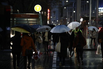
Pedestrians endure a wet and gloomy walk through the Sydney CBD on Friday.Credit:Dominic Lorrimer
The heaviest rainfall will be along the South Coast with totals possibly exceeding 200 millimetres.
The bureau is forecasting 120-200 millimetres for Bega on Saturday and 80-150 millimetres on Sunday.
That's the second such bout in a fortnight in an area that largely missed out on drought-breaking rains.
Also collecting some rain at least has been the state's far west. "Broken Hill is very excited," Ms Kirkup said. The 20-plus millimetres, though, have been enough to cut off some areas including the village of Silverton, she said.
The cold weather and moisture have also brought snow to the mountains in recent days, Mr Domensino said.
Higher peaks in the NSW Alps could collect as much as a metre of snow this weekend, building on relatively shallow foundations for this time of year.
Loading
After a few days of relatively calm conditions in the middle of next week, another strong cold front will move across Australia from the west.
"The right ingredients are there for another period of dynamic weather for NSW," Mr Domensino said.
"We could see another low develop in the Tasman Sea by late next week."
At this stage, the climate models offer different views of what will happen when the cold air meets the warmer air over the Tasman Sea, Ms Kirkup said.
The model projections are "really all over the place", she said.
Get our Morning & Evening Edition newsletters
Peter Hannam writes on environment issues for The Sydney Morning Herald and The Age.


